The weather in England and Wales has taken a turn for the worse, as a yellow weather warning is in place due to heavy rainfall that is expected to cause travel disruptions. The Met Office has issued this warning for the majority of England and Wales, lasting until Tuesday evening. In addition to the rain, there will also be strong winds in certain areas. This article will examine the potential impacts of this severe weather and provide advice for those affected.
According to the Met Office, the southwestern and southern regions of England, as well as south Wales, will experience the highest levels of rainfall on Monday evening and overnight. Although the specific areas affected on Tuesday are not yet clear, Wales, the Midlands, eastern England, and Yorkshire are more likely to be drenched. The rain is expected to clear by midday on Tuesday in southwestern England and south Wales, but it may persist in the northeast of the warning area until the evening. The yellow rain warning will be in effect until 9pm on Tuesday.
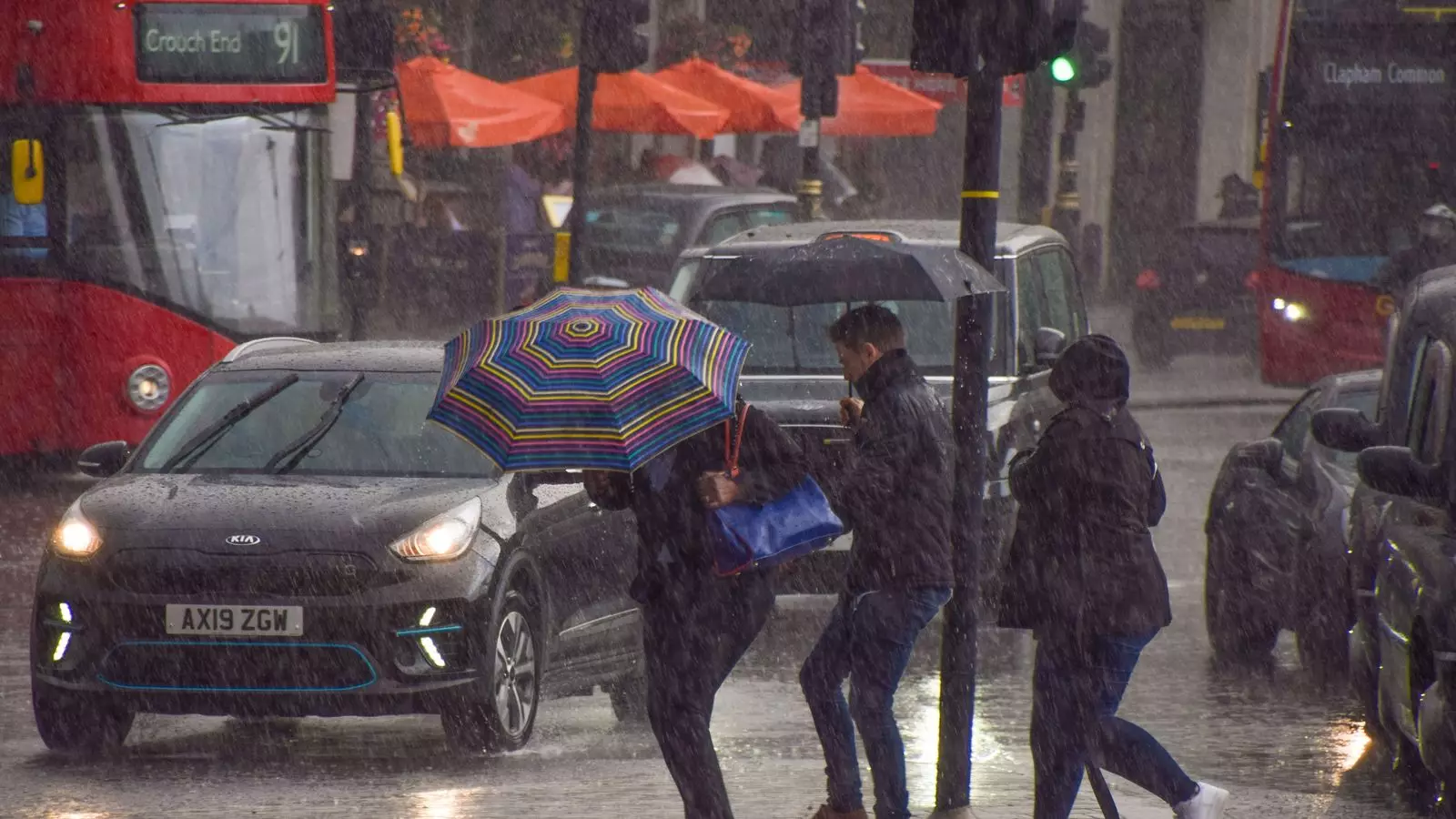
The heavy downpour is likely to result in spray and flooding on roads, leading to longer travel times. Bus and train services may also face delays, adding to the travel disruptions. The Met Office predicts that between 15 to 30mm of rain will fall widely across the warning area, with some areas seeing up to 50mm of rainfall. This amount of rain poses a risk of flooding to homes and businesses.
In addition to the heavy rain, a yellow wind warning will also be in place across several parts of England and Wales. These windy conditions are expected to develop rapidly, starting from 8am on Tuesday and lasting until 9pm. Southwest England and southern Wales will experience the initial impacts, with the winds then spreading eastwards to southern and central parts of England.
Coastal areas are likely to experience gusts of wind reaching up to 60mph, while inland areas can expect gusts of 40 to 50mph. There is a lower chance of gusts reaching 55 to 60mph, but the confidence in predicting the extent of these gusts is currently low. The strong winds are expected to cause travel disruptions in several areas including the East Midlands, East of England, London and South East England, South West England, Wales, and West Midlands.
As a result of the severe weather conditions, the government has issued more than 70 flood warnings, primarily in the Midlands and Wales. These warnings aim to inform the public about areas where flooding is expected. Additionally, over 250 flood alerts have been issued across England and Wales, highlighting areas where flooding is a possibility.
Those planning to travel in the areas affected by the yellow warnings are advised to check road conditions in advance and make necessary adjustments to their travel plans. It is crucial to stay up to date with the latest weather forecast and heed any advice or warnings from local authorities.
The yellow weather warnings for heavy rain and strong winds in England and Wales necessitate caution and preparedness from the public. The potential for travel disruptions, flooding, and other adverse impacts highlights the importance of staying informed and taking necessary precautions. By being proactive and following the guidance provided by the Met Office and local authorities, individuals can minimize the negative effects of the severe weather conditions.
Leave a Reply