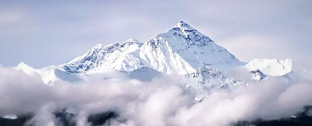
Mount Everest, known to many as Chomolungma in Tibet and Sagarmatha in Nepal, captivates numerous adventurers and scientists alike with its majestic presence. As the tallest peak in the world, standing at an astonishing height of 8,849 meters, Everest has long been the subject of inquiry regarding the geological forces that led to its prominence among the Himalayas. A recent analysis conducted by scientists from the China University of Geosciences and University College London has introduced a groundbreaking concept—geological piracy—that could explain why Everest towers an impressive 250 meters higher than many of its neighboring peaks. This idea goes beyond tectonic forces and delves into the complex interactions of river systems that have influenced the topography of this formidable mountain range.
In geological terms, “piracy” does not refer to swashbucklers on the high seas but instead describes a phenomenon by which one river captures the drainage of another, altering the landscape significantly. In the case of Everest, researchers propose that the Arun River, a crucial tributary within the region, has played a pivotal role in the mountain’s development over the past 89,000 years. The models suggest that as the Arun began capturing water from its larger neighbor, the Kosi River, a dramatic transformation occurred. Initially, the sheer volume of water in the Arun carved deep gorges and incised the surrounding landscape. This process effectively reshaped the region’s sediment flow and dynamic.
At the heart of this inquiry lies the relationship between river erosion and tectonic uplift. Generally, one would expect peaks of similar geological composition along a fault line to experience consistent elevations. However, Everest’s extraordinary rise challenges this assumption. By analyzing the surface uplift resulting from the Arun River’s drainage changes, scientists postulate that the removal of significant rock masses led to a rebound effect in the Earth’s crust. This rebounding process causes certain areas, including Everest, to elevate. According to this hypothesis, between 15 and 50 meters of Everest’s current height can be attributed to the immense power unleashed by river drainage piracy. In a system where erosion remains balanced, weight bearing down on the crust remains stable. The abrupt alteration caused by river capture, however, resulted in unprecedented rates of local uplift, estimated at 0.53 millimeters annually.
The findings from the research team not only enhance our understanding of Mount Everest’s formation but also raise intriguing questions about other mountainous regions around the globe. How many other peaks owe their altitude and distinctiveness to similar geological processes? Moreover, as scientists engage in this conversation, it is crucial to critically evaluate the models in place. While geological piracy presents a compelling narrative, ongoing research will be essential in verifying these hypotheses. Scientists must consider layers of sedimentary records, historical river paths, and other geological forces that could contribute to variations in peak heights, thus creating a more rounded understanding of the remarkable interplay of forces that shape our planet.
As geologists continue to investigate the link between river dynamics and mountain formation, the implications of this research extend far beyond the Himalayas. Understanding the mechanisms that lead to the formation of the world’s highest peaks may redefine our grasp of earth sciences as a whole. It can lead to enhanced predictive models for understanding how natural processes—particularly in the context of climate change and human impact—might affect the intricate balance between erosion and uplift. The study of Mount Everest serves as an important case study that challenges existing paradigms and inspires curiosity about the complex workings of our planet.
Ultimately, the story of Mount Everest is more than a tale of tectonic triumph; it underscores the intricate interplay of water, land, and geological history. The advent of theories like geological piracy opens up exciting avenues for exploration and discovery, shedding light on how rivers, mountains, and the Earth itself evolve over time. As research continues to evolve, so too will our understanding of this iconic peak and the forces that have shaped it into the monumental titan it is today.
Leave a Reply