An amber wind warning has been issued across parts of the UK as Storm Henk approaches. The warning, which covers southern England, the Midlands, East Anglia, and Wales, indicates the potential for disruption to travel and the risk of flying debris that could lead to injuries or danger to life. Effective from 10am to 8pm today, this warning highlights the severity of the storm and the need for caution.
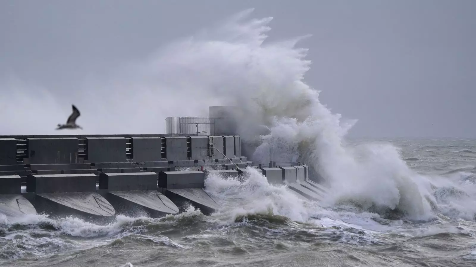
Alongside the amber warning, a yellow wind warning is in place for the whole of southern England and Wales until 9pm today, although this warning is less severe. Residents living near the coast have been advised to stay away from large crashing waves, as they can be dangerous and potentially drag people out to sea. By taking precautions and avoiding risky areas, individuals can help mitigate the risks associated with Storm Henk.
The Met Office has provided insights into the expected wind gusts and their potential impact. Exposed coasts in the west are likely to experience gusts of 70-80mph, while gusts of 50-60mph are more probable inland, with one or two places possibly experiencing brief gusts of 60-70mph. These strong winds can disrupt travel, damage property, and potentially cause harm to individuals if proper precautions are not taken.
Advice for Motorists and Homeowners
The government agency is urging motorists to drive slowly in order to maintain control of their vehicles in the face of strong winds. Homeowners are advised to secure their garden furniture and other loose objects to prevent them from causing damage or becoming dangerous projectiles. By following these guidelines, individuals can play a proactive role in ensuring their safety and minimizing potential damage caused by Storm Henk.
In addition to the wind warnings, the Met Office has issued a yellow warning for rain across a large stretch of the country, extending as far as Manchester and Hull. Some areas within this warning zone could experience 35-50mm of rainfall. The worst of the rain is expected to clear southwestern areas of England and South Wales by midday, but it may persist into the evening across the northeast. Consequently, roads are likely to be affected by spray and flooding, potentially leading to prolonged journeys and delays in bus and train services.
Flood Warnings and Alerts
Across England and Wales, more than 115 flood warnings have been issued, predominantly in the Midlands, with over 320 flood alerts also in place. In Scotland, there are currently five alerts and one warning. Flood warnings serve to inform the public about areas where flooding is expected, while flood alerts indicate areas where flooding is a possibility. The large number of warnings and alerts highlights the potential for significant flood-related impacts from Storm Henk.
As Storm Henk approaches, it is vital for individuals in the affected areas to remain vigilant and heed the warnings issued by the Met Office. By taking appropriate precautions, such as securing loose objects and avoiding coastal areas, people can minimize the risks associated with the storm. Motorists should drive with caution and be prepared for possible travel disruptions, while those living in flood-prone areas should stay informed about the latest updates and take necessary actions to protect themselves and their property. Ultimately, by prioritizing safety and being prepared, individuals can navigate the challenges posed by Storm Henk and minimize its impact on their lives.
Leave a Reply